Teide National Park · La Orotava, Tenerife
Mount Teide
Everything you need to know before you go: Getting there, parking, prices, best time.
Last checked: September 2026
Common questions, answered
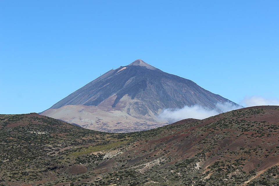
The cable car takes you from 2,356 m to 3,555 m in about eight minutes. The last 172 metres to the summit crater are a steep trail, and you may only walk it with a permit booked for your day and time slot.
Straight talk
What to know before you go.
- The cable car ticket is not the summit. It only takes you to 3,555 m. Without a permit you stay on the two viewpoint trails.
- Permits run out. Slots are limited and open 28 days ahead. Permits are non-refundable unless the trail closes or the cable car is not running.
- Thin air. The national park warns that the ascent can be dangerous for people in delicate health or of advanced age, especially with heart or lung conditions.
- Boots and a jacket even in summer. The park asks for mountain boots and warm clothing even on warm days, plus sunglasses, a hat and sunscreen. The weather changes fast.
Getting there
You drive to the cable car, ride up, and walk the last stretch with a permit.
By car
- 01From the north coast take the TF-21 via La Orotava up into the park. From the south take the TF-21 via Vilaflor, or the TF-38 from Chío. From La Laguna the TF-24 runs along the ridge to El Portillo.
- 02In the park all roads join the TF-21. The cable car base station sits on it between El Portillo and the Parador.
- 03Park next to the base station. The cable car rides to La Rambleta at 3,555 m in about eight minutes.
- 04From the top station, trail 10 (Telesforo Bravo) climbs 690 m and 172 m up to the summit crater. Plan about 45 minutes, and only in the time slot on your permit.
In winter the TF-21 and TF-24 close after snow or ice. In February and March 2026 this happened several times. Check the roads and cable car status on the morning you go.
Other
Bus 342 from the south
From Costa Adeje and Los Cristianos via Vilaflor, about 2 h 15 min. The bus is wheelchair accessible. It heads back in the afternoon, well before the cable car closes in summer.
Bus 348 from the north
From Puerto de la Cruz via La Orotava, about 1 h 40 min. On the way back it only drops passengers off from Aguamansa down, it doesn't pick anyone up.
Missing the bus back
There is no later bus from the cable car. The only way down then is a taxi.
Guided day tour
The cable car operator and other companies sell day tours with transport and cable car. The tour sets the timing; the summit still needs a permit.
Loading map …
- Destination
- Parking
Check before you go
Snow and ice can close the TF-21 and TF-24 at short notice, and wind, ice or technical faults can stop the cable car. The operator posts the cable car status on its site every day; the Cabildo reports road closures and alerts.
Parking & arriving
On site
The cable car rides from the base station at 2,356 m to La Rambleta at 3,555 m in about eight minutes. Up there two free trails lead to viewpoints over Pico Viejo and La Fortaleza; the summit trail needs a permit.
- Time there
- ~2 h with the cable car and a viewpoint trail, ~3 h with the summit
- Walk from car park
- a few steps from the car park to the base station
- Toilets
- At the base and top stations
- Food & drink
- Restaurant at the base station; only vending machines at the top
When is it worth it?
Tap a time of day to see what the cable car and permit allow.
Morning
10:00The recommendation. The first cable car goes up at 9:00. An early summit slot leaves time for the two free viewpoint trails before the last descent.
00–09Before 9:00
The cable car is closed. The summit is only allowed this early if you spend the night at the Altavista refuge and leave the summit area before 9:00.
09–12Morning★ Recommended
The recommendation. The first cable car goes up at 9:00. An early summit slot leaves time for the two free viewpoint trails before the last descent.
12–16Midday to afternoon
Still fine for a ride up. Outside July to September the last ascent is between 16:00 and 17:00, depending on the date.
16–19Late afternoon
Only July to September and over Easter: last ascent 17:40, last descent 18:30. At other times the cable car has already stopped.
19–24Evening and night
The cable car is closed, but the park roads stay open. Very dark sky away from the coast. It gets cold at night.
Cable car hours 2026. Your summit permit is valid only for the booked day and time slot.
Jan – Mar
Snow and ice possible. TF-21 and TF-24 were closed several times in 2026. Cable car 9:00–17:00.
Apr – Jun
Cable car 9:00–17:00, over Easter 2026 until 18:40.
Jul – Sep
Longest hours: 9:00–18:40, last ascent 17:40, last descent 18:30.
Oct – Dec
Hours shrink in steps, from 25 October back to 9:00–17:00. Cold at the top.
Forecast
Facts
- Elevation
- Source: National park · 09/2026
- 3,715 m, the highest point in Spain
- Cable car
- Source: Teleférico del Teide · 09/2026
- Base 2,356 m, top station La Rambleta 3,555 m, about 8 minutes
- Cable car tickets 2026
- Source: Teleférico del Teide · 09/2026
- Return €42 adults, €21 children 3–13. One way €23.50. Canary residents €10.50
- Summit permit (trail 10)
- Source: Cabildo · 09/2026
- €15 non-residents, €6 other Canary residents, free for Tenerife residents and under-14s
- Trail 10 to the summit
- Source: National park · 09/2026
- 690 m, 172 m ascent, about 45 min, slots 9:00–17:00
- Booking
- Source: National park · 09/2026
- Online at Tenerife ON. A new week opens every Monday at 7:00, always 28 days ahead
- Free trails at the top
- Source: National park · 09/2026
- Trail 11 to Mirador de La Fortaleza (610 m) and trail 12 to Mirador de Pico Viejo (730 m), no booking
- Hike from below (trail 7)
- Source: National park · 09/2026
- 8.2 km, 1,309 m ascent, about 5.5 h. Booking required: €6 weekdays, €10 weekends for non-residents
- Park entry and roads
- Source: National park · 09/2026
- Free
- Bus
- Source: TITSA · 09/2026
- Line 342 from Costa Adeje 9:25, back from the cable car 15:40. Line 348 from Puerto de la Cruz 9:30, back 16:05. Daily
Nearby
- Mirador La FortalezaViewpoint · 400 m as the crow flies · Google Maps
- Mirador del TeideViewpoint · 400 m as the crow flies · Google Maps
- Teide Cable Car2.6 km as the crow flies · Google Maps
- Teide National Park3.1 km as the crow flies · Google Maps
- Mirador El Tabonal NegroViewpoint · 3.5 km as the crow flies · Google Maps