North coast · Los Realejos, Tenerife
Rambla de Castro
Everything you need to know before you go: Getting there, parking, prices, best time.
Last checked: September 2026
Common questions, answered
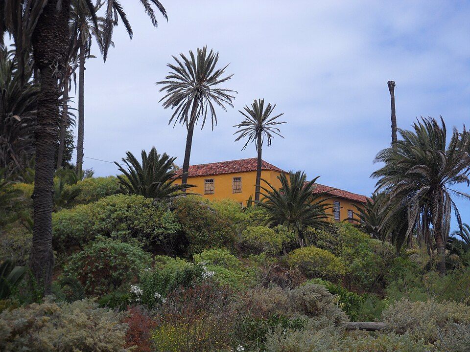
Cliffs, palms and an old estate between Puerto de la Cruz and Playa del Socorro. From the Mirador de San Pedro on the TF-5 a path leads 680 m down to the Casona de Castro and on to a small fort with three cannons. Entry and parking are free, but the car park is small.
Straight talk
What to know before you go.
- The beach is closed. The way down to Playa de Castro is fenced off because of rockfall and strong currents. On 3 August 2026 rocks came down onto the beach while people were on it.
- A tiny car park. The start has one small free car park. Visitors regularly complain about how few spaces there are.
- Not a loop. The coastal path runs one way. You walk back the same route or combine it with the bus.
- "Easy" with 312 m of climbing. Officially easy, but there are steep steps at both ends. Not suitable with limited mobility.
- The Casona stays shut. You see the manor house from outside. Inside is only for booked groups of ten or more.
- Gordejuela only from outside. The much-photographed ruin is fenced off. Next to it are working water galleries and parts of it may collapse.
Getting there
The Rambla is a 46-hectare protected landscape on the north coast. Start at the Mirador de San Pedro and walk down to the palm grove, the manor house and the fort.
By car
- 01From Puerto de la Cruz take the TF-5 west towards Icod. About 200 m after km 41 turn off for the Mirador de San Pedro.
- 02Park in the small car park by the road. The viewpoint, a restaurant and an information board are 125 m further on.
- 03From the viewpoint follow the signs downhill: 680 m on paths and steps to the Casona de Castro and its palm grove, then on to the Fortín de San Fernando above Playa de Castro.
- 04The coastal path continues east to the Mirador El Burgado near Puerto de la Cruz. It is not a loop: walk back the same way or return by bus from El Burgado.
The car park fills up. The fallback is the roadside parking at Playa del Socorro, about 800 m west, with a climb back up the old cobbled Camino Real.
Other
From Puerto de la Cruz
Lines 363 and 383 together run several times an hour on weekdays, 363 less often at weekends. Get off at San Agustín and walk 180 m to the viewpoint.
One way, bus back
Walk the coastal path east to El Burgado and take city bus 381 back into Puerto instead of retracing your steps.
From Santa Cruz or the south
Take line 102 from Santa Cruz or 343 from Costa Adeje and the airports to Puerto de la Cruz bus station, then change to 363 or 383.
Loading map …
- Destination
- Parking
Check before you go
Sections of the coastal path and the way down to the beaches can be closed at short notice after rockfall or for maintenance. Tenerife ON, the Cabildo's trail portal, shows the path page and current alerts, including wildfire alerts.
Parking & arriving
On site
From the viewpoint you look over palms and cliffs to the Atlantic. Paths and steps lead down to the Casona, which you only see from outside, and on to the small fort with its cannons above Playa de Castro.
- Time there
- ~1 h to the fort and back; ~3.5–4 h for the whole coastal path there and back
- Walk from car park
- 125 m to the viewpoint, then 680 m down to the Casona
- Toilets
- None along the path. Nearest public toilet at Playa del Socorro, ~1 km
- Food & drink
- Restaurant and bar at the viewpoint. No drinking water along the path
- Shade
- Only in the palm grove
- Wheelchair
- The viewpoint yes, the path no
- Dogs
- On a lead
When is it worth it?
There are no opening hours. Tap a time of day.
Morning
08:00The best chance of a space in the small car park, and the cooler part of the day for the climb back.
00–10Morning★ Recommended
The best chance of a space in the small car park, and the cooler part of the day for the climb back.
10–17Day
The hottest hours for the steps back up to the car park.
17–20Evening
The viewpoint looks out over the Atlantic. Head back before dark: the path has steps and runs along cliffs.
20–24Night
Access stays free, but this is a cliff path, not a night walk.
Free access to the protected landscape all year. Individual visitors do not need to book.
All year
Walkable in every month. Skip it in rain or strong wind.
After heavy rain
Los Realejos warns of rockfall on some sections of the coast path.
Summer
Playa de Castro below the fort is fenced off. Swim at Playa del Socorro instead, 1 km west, Blue Flag 2026.
Birdwatching
One of the town's birding spots. Cory's shearwaters breed on the cliffs.
Forecast
Facts
- Protected landscape
- Source: Gobierno de Canarias · 09/2026
- Rambla de Castro (T-28), 45.9 ha, Los Realejos
- Coastal path
- Source: Tenerife ON · 09/2026
- Mirador de San Pedro – Mirador El Burgado, 4.36 km one way, ~1 h 50 min, 312 m of climbing
- Difficulty
- Source: Tenerife ON · 09/2026
- Rated easy in the official trail data
- Casona de Castro
- Source: Operator · 09/2026
- Manor of an estate founded in the early 16th century. Inside only guided group visits (10+), booked ahead
- Fortín de San Fernando
- Source: Los Realejos · 09/2026
- Small coastal fort from the late 18th century, 1808 on the facade, three cannons left
- Gordejuela
- Source: Operator · 09/2026
- Ruin of a 1903 water pumping station, about 860 m east. Fenced off, no entry
- Entry
- Source: Tenerife ON · 09/2026
- Free. Individuals need no booking, groups book on Tenerife ON
- Bus
- Source: TITSA · 09/2026
- Lines 363 and 383, stop San Agustín, 180 m. City line 381 at El Burgado, the eastern end
Nearby
- Playa del SocorroBeach · 900 m as the crow flies · Google Maps
- Mirador El LanceViewpoint · 1.5 km as the crow flies · Google Maps
- Mirador de La CoronaViewpoint · 1.9 km as the crow flies · Google Maps
- Playa de los RoquesBeach · 2.2 km as the crow flies · Google Maps
- Zona Recreativa Barranco de Ruiz3.3 km as the crow flies · Google Maps